High-Resolution Soil Moisture Data Reveal Complex Multi-Scale Spatial Variability Across the United States
Abstract
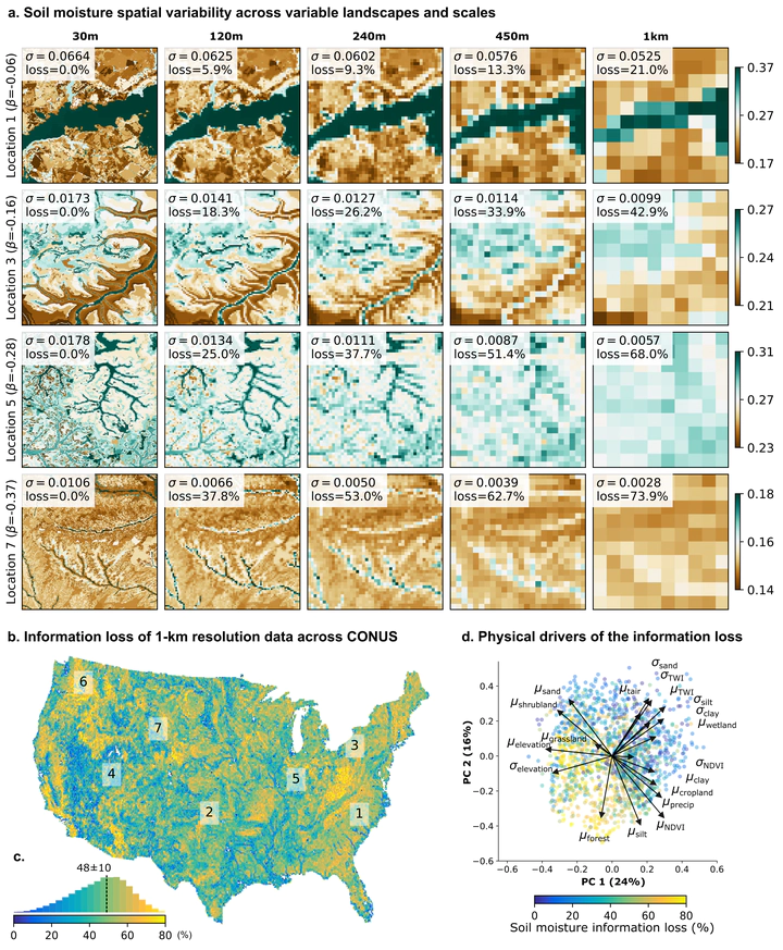
Soil moisture (SM) spatiotemporal variability critically influences water resources, agriculture, and climate. However, besides site-specific studies, little is known about how SM varies locally (1–100-m scale). Consequently, quantifying the SM variability and its impact on the Earth system remains a long-standing challenge in hydrology. We reveal the striking variability of local-scale SM across the United States using SMAP-HydroBlocks — a novel satellite-based surface SM data set at 30-m resolution. Results show how the complex interplay of SM with landscape characteristics and hydroclimate is primarily driven by local variations in soil properties. This local-scale complexity yields a remarkable and unique multi-scale behavior at each location. However, very little of this complexity persists across spatial scales. Experiments reveal that on average 48% and up to 80% of the SM spatial information is lost at the 1-km resolution, with complete loss expected at the scale of current state-of-the-art SM monitoring and modeling systems (1–25 km resolution).