Noemi Vergopolan
Noemi Vergopolan
Home
Research
Team
Publications
News & Social
Join Us
Contact
Agriculture
Soil vertical heterogeneity reduces rootzone soil moisture bias in hyper-resolution land surface model over smallholder agricultural systems
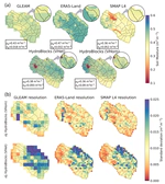
Where soil differs with depth, models that carry water-holding properties inferred at the surface down the whole column bias the moisture reaching crop roots. We applied depth-varying properties to a hyper-resolution land surface model resolving individual agricultural fields at 30 meters. Against ground measurements, systematic surface soil moisture biases dropped by about 14%, with error spread and timing unchanged, correcting the mean state rather than daily dynamics.
Vishnu U. Krishnan
,
Noemi Vergopolan
,
Bhupendra Bahadur Singh
,
J. Indu
,
Lanka Karthikeyan
PDF
DOI
Transfer learning for improved crop yield predictions in a cross-scale pathway: a case study for Brazilian national soybean
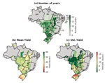
Many countries report crop yields only for large administrative units, so models trained on coarse records must be applied at finer scales, where few samples and scale-dependent relationships degrade accuracy. A machine learning model trained on field-level soybean yields in the US Midwest was fine-tuned with Brazilian state-by-year records, a technique called transfer learning, then used to predict municipal yields from 2001 to 2021. Transfer across scales rather than across regions had rarely been tested. Without any municipal training data, explained yield variance rose from 0.29 to 0.44, though transfer added little where fine-scale data were plentiful.
Jiaying Zhang
,
Kaiyu Guan
,
Zhangliang Chen
,
Yizhi Huang
,
Kejie Zhao
,
Bin Peng
,
Sheng Wang
,
Xiaocui Wu
, …,
Noemi Vergopolan
,
et al.
PDF
DOI
What discrepancies between farmer perceptions and observational data teach us about smallholder decision making
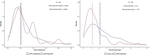
Much of what is known about smallholder farming rests on farmers’ own knowledge, and gaps between them and instruments used for measurements are usually treated as error. Reported field size, harvest and season timing from 640 maize farms in Zambia were checked against GPS boundaries, weighed harvests and satellite rainfall. The discrepancies were structured rather than random: small fields were overstated and large ones understated, while low harvests were understated and high ones overstated. Read instead as conceptual mismatch, they point to farmers and researchers holding different mental models.
Kurt Waldman
,
Jordan Blekking
,
Meha Jain
,
Chewe Nkonde
,
Noemi Vergopolan
PDF
DOI
Dynamic geospatial modeling of mycotoxin contamination of corn in Illinois: unveiling critical factors and predictive insights with machine learning
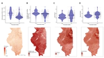
Aflatoxin and fumonisin contamination of corn costs the United States up to an estimated $1.66 billion a year, yet the forecasting models used elsewhere have no US counterpart. Machine learning models were trained on 1,772 mycotoxin measurements from Illinois corn between 2003 and 2021, paired with daily rather than monthly weather, satellite greenness and county soil properties, which sets them apart from an earlier attempt in the state. High contamination events were rare. Even so, the best models reached 96% and 92% balanced accuracy on withheld data. Carbonate-rich soils tracked lower aflatoxin and wetter soils higher fumonisin, relationships that remain correlational.
Lina Castano-Duque
,
Edwin Winzeler
,
Joshua M. Blackstock
,
Cheng Liu
,
Noemi Vergopolan
,
Marlous Focker
,
Kristin Barnett
,
Phillip Ray Owens
,
et al.
PDF
DOI
How Much Control do Smallholder Maize Farmers Have Over Yield?
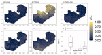
Attributing a smallholder harvest to the farmer’s decisions rather than to soil and weather has been difficult, since field records are scarce. A process-based crop model simulated maize yields across all 72 of Zambia’s districts from 1979 to 2016, varying cultivar, fertilizer rate and planting date, which resolves those three choices separately for the first time nationally. Management explained 53% of yield variance overall, from 27% in the drier south to 82% in the wetter north, where fertilizer alone accounted for 72%.
Michael Cecil
,
Allan Chilenga
,
Charles Chisanga
,
Nicolas Gatti
,
Natasha Krell
,
Noemi Vergopolan
,
Kathy Baylis
,
Kelly Caylor
,
et al.
PDF
DOI
Is Closing the Agricultural Yield Gap a “Risky” Endeavor?
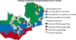
While potential maize yields in Zambia are 9 t per hectare (t/ha), the average farmer produces only 1–2. We evaluate the contribution of responses to weather risk to that gap by decomposing the yield gap in maize in Zambia. Risk aversion explained 24% of the average gap, varying widely by location, implying 6.75 tons per hectare attainable without added risk against 8.84 when maximizing profit.
Nicolas Gatti
,
Michael Cecil
,
Kathy Baylis
,
Lyndon Estes
,
Jordan Blekking
,
Thomas Heckelei
,
Noemi Vergopolan
,
Tom Evans
PDF
DOI
A comprehensive assessment of in situ and remote sensing soil moisture data assimilation in the APSIM model for improving agricultural forecasting across the U.S. Midwest
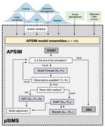
Soil water is a major uncertainty in crop models, and correcting it against measured soil moisture can reduce uncertainty on yield gain estimation. We tested 19 site-years of corn and soybean at five US Midwest sites, 2011 to 2019, and tested such corrections using in-situ sensors and satellite soil moisture, including SMAP-HydroBlocks, a 30-meter product not previously used in a crop model. Sensors improved yield estimates in 63% of site-years, mostly under water stress. The satellite data constrained the soil profile far more weakly yet still cut yield error by a median 17.2%.
Marissa Kivi
,
Noemi Vergopolan
,
Hamze Dokoohaki
PDF
DOI
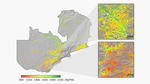
Field-scale Crop Yield Prediction
Satellite observations, physical models, and machine learning combined can enable crop yield prediction at high spatial resolution at data-scarse regions. Learn more about it
here
.
Last updated on Sep 28, 2026
From Hydroclimate Data to Science-Informed Decisions
Integrating computational models and hydroclimate data for actionable agriculture decision-making. Towards resilience and adaptability in a changing climate.
Last updated on Sep 11, 2023
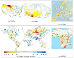
A global near-real-time soil moisture index monitor for food security using integrated SMOS and SMAP
Soil moisture is a direct measure of agricultural drought, yet operational global indices rely on rainfall or model estimates rather than observed soil water in near-real time. We developed the first operational global soil moisture index from merged near-real-time satellite data, mapping daily percentiles at a 7-8 day lag. Over the Canadian Prairies it tracked the dry 2012-2013, wet 2016 and severe 2017 drought.
Sara Sadri
,
Ming Pan
,
Yoshihide Wada
,
Noemi Vergopolan
,
Justin Sheffield
,
James S. Famiglietti
,
Yann Kerr
,
Eric F. Wood
PDF
Cite
DOI
»
Cite
×